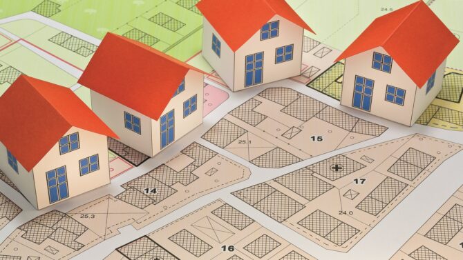
Planning Regulations in France
Arthur Cutler looks at the differences between local and national planning regulations and how they can affect you…
Although planning regulations may not be the most ‘interesting’ part of your purchase and ownership of a property in France, it is essential that you are aware of the general principles involved, the differences between local and national regulations, and of course, how they impact any proposed changes you may wish to make to your property – or indeed for the construction of any new dwelling.
In France, even the smallest of communes has the right (but not the obligation) to create a local planning framework. In the absence of that, there exists a national framework governing those areas where no local plan is in place. More and more communes are joining together to form an ‘intercommunal local plan, and that adds further considerations that could be relevant to your project.
Let me quickly introduce you at this stage to one of my most-used phrases: ‘it depends’. This is a pre-cursor to all that follows, which is intended as a useful guide, but local idiosyncrasies mean that you shouldn’t assume your project necessarily falls within the norm when it comes to planning rules. Taking good advice before setting forth with a hammer or trowel will be time very well spent!
The regulatory framework is as follows:
National Regulations
These apply anywhere not covered by a local plan and are known as RNU (règlement national d’urbanisme). They are used to control what can or can’t be built in any given area or commune. Planning decisions resulting from applications where RNU applies will be based primarily on whether the project is within the existing urban area of the commune, though there is no specific definition of exactly what that means, or where the line is drawn between urban and rural zones.
The use of existing land in the immediate vicinity, size of development, noise, public health and safety, architectural style and so on will all play a part in the planning process and affect the outcome. Properties in a hamlet of 10 houses set 3km from the main town or village centre are unlikely to be considered as being within the constructible zone, which means development is likely to be limited as follows:
Small extensions to the existing property are likely to be permitted – usually up to 30m² footprint.
- Annexes (garages, sheds etc) are now likely to be refused, unless they are attached to an existing building. Stand-alone annexes are becoming more difficult to obtain planning consent for in communes covered by RNU.
- Applications for new-build projects are very unlikely to be granted unless the owner is a registered farmer (and getting registration is an arduous and difficult process).
- Camping, glamping or other holiday-type businesses are likely to be refused.
LOCAL REGULATIONS
There are a number of different models in use for local planning policy, with each version existing to control planning matters within the commune. The more usual ones are the PLU (plan local d’urbanisme), and the CC (carte communale).
The first of these is the most detailed version and will place all land in a commune into one or more planning ‘zones’, ranging from agricultural to industrial, and from parkland to residential. Each zone will have its own set of rules defining what can or can’t be achieved, taking account of an overall plan set by the commune for the development of the area.
A carte communale essentially just divides the commune into constructible and non-constructible zones, without setting specific regulations for each. There is a current move towards smaller communes joining together to form larger planning groups, sharing a common regulatory framework called a PLUi (plan local d’urbanisme intercommunal). Let’s take a look at how these work and the various zoning implications that are likely to be included.
CREATING A PLUI
When communes join together to create this type of planning policy, the first step is to appoint a specialist agency to propose the basis of the local plan – a draft document for the various individual communes to discuss. This draft will include all of the various zones that may be required, but at this stage there is no decision on which land will be in which zone. The most usual zones are as follows, although there can be many others:
- Urban:
Those areas deemed to be in the urban area of the commune(s) – town centres, for example. Urban zones carry the prefix U, often followed by one or more letters to denote sub- zones. For example, Ua, Ub, Uc etc. Different regulations will apply to each sub-zone.
- Future urban zones:
These are zones that will be designated for development at a future date, although the timeframe for that to happen can be lengthy, and at this stage is lacking in detail. These are noted as AU zones, usually with a numerical prefix (e.g. 1AU), but can also be followed by other letters (e.g. 1Auh, 1Aui etc) to denote sub-zones with specific requirements.
- Agricultural:
Zones are given the prefix A, with additional sub-zones (e.g. Aa, Ab, Ah etc). Agricultural zones often account for the largest overall areas of a commune and development is mostly restricted to farming activities, although existing residential properties can usually be extended, for example. However, it is becoming more difficult to convert barns and other outbuildings into dwellings in agricultural zones.
- Natural:
This covers areas where a variety of protections exist to prevent development that can affect flora, fauna, and so on, such that limited possibilities exist for new construction, conversion etc. Once more, there are often sub- zones in the draft document (e.g. Na, Nh etc).
Once the draft document has been established, communes move onto the next step and begin creating a zoning map to place land into one or other of the main zones, and sub-zones where relevant, and refining what can or cannot be permitted within each. This can be a long process, taking several years to complete. At the end of this stage, there will be a period of public consultation when people can review the document and zoning map to see how it affects their particular property. Requests can be made at this stage by individual property owners for their property to be zoned differently. There is no guarantee a request will be agreed, but it will be reviewed independently for fairness.
Once all considerations have been taken into account, a final version of the PLUi will be created and voted upon, both at individual communal level, but also at the prefectorial level. Changes can still be made until a definitive version is approved by all the authorities concerned. A date is then set for the PLUi to come into force.
Depending on the area in question, many communes also have regulations to take account of a variety of natural risks, such as flood, fire and subsidence. A regulatory framework may exist setting out risk-prevention measures that affect or rule out certain types of development.
What happens with planning applications during the PLUi creation process? This is really important to understand. Technically, applications must be processed on the regulations in force at the time of a submission, but even where current regulations may permit a certain development, the planning office has the right to include a ‘sursis à statuer‘ condition when issuing the result of an application. Essentially, this allows them to defer consent (or refusal) until such time as the final version of the PLUi has been adopted. If that means the development would not be allowed under the new regulations, then the project can still be refused.
Additionally, if an application is submitted on 1 January, for example, and there is a two-month processing period, then if the PLUi comes into force before the end of that processing period, the planning office can issue the outcome based on the regulations at the time of the decision, not on the date of submission.

© SHUTTERSTOCK
Tom Easdown runs French Plans, Tel: +33 (0)6 75 05 36 86
The unique mix of legal, financial and tax advice along with in-depth location guides, inspiring real life stories, the best properties on the market, entertaining regular pages and the latest property news and market reports makes French Property News magazine a must-buy publication for anyone serious about buying and owning a property in France.
Lead photo credit : © SHUTTERSTOCK
Share to: Facebook Twitter LinkedIn Email
More in Building property, Planning
Related Articles

By French Plans
Leave a reply
Your email address will not be published. Required fields are marked *